Ever stared at a physical map of Himachal Pradesh and wondered, “How do all these rivers, ranges, and valleys fit together?”
Himachal is a land of diversities in the planet earth and geography of Himachal Pradesh is an essential subject to be studied to know himachal even more better. As a student or traveler, understanding this state’s geography means more than memorizing rivers or ranges. It’s about seeing how land, climate, and people interact.
Learning Himachal’s geography is a journey. And yes, while a single article can’t cover everything, but here, you’ll find an easy overview, practical insights, and all the important stats and visuals students love for exams and projects and a traveler loves to see how his trip will go easy.
Key Facts of Himachal Geography
| Attribute | Detail |
| Location | Western Himalayas, India |
| Area | 55,673 km², of which approximately 37,033 km² is forest cover (~27.7%) |
| Altitude Range | From about 350 meters (Una plains) to 6,975 meters (Reo Purgyil peak, Kinnaur) |
| Neighboring Regions | North: Jammu & Kashmir and Ladakh; East: Tibet (China); Southwest: Punjab; Southeast: Uttarakhand |
| Districts | 12, grouped into 3 administrative divisions: Kangra, Mandi, Shimla |
| Largest district | Lahaul & Spiti (13,835 km²), but the least populated (~31,500) due to its harsh terrain. |
| Smallest district: | Hamirpur (~1,118 km²). |
| Sub-Divisions: | 73 |
| Tehsils and Sub-Tehsils | Around 172 |
| Development Blocks | Approximately 78 |
| Urban Local Bodies | 54 |
| Gram Panchayats | 3,615 |
| Population (2025 est.) | Around 7.55 million |
| Most populated district | Kangra (~1.5 million) |
| Highest population density | Hamirpur |
| Lowest population density | Lahaul & Spiti |
| Official Language | Hindi |
| Capital(s) | Shimla (summer), Dharamshala (winter) |
| State Animal | Snow Leopard |
| State Bird | Western Tragopan (Jujurana) |
| State Flower | Pink Rhododendron |
| Major Rivers | Sutlej, Beas, Ravi, Chenab (Chandra-Bhaga), Yamuna; all perennial and snow-fed |
| Forest Cover | Roughly 27.7% (language to maps), ~15,433 km² |
| Literacy Rate | 83.78% overall (Male: 90.83%, Female: 76.60%) |
| Highest Peak | Reo Purgyil – 6,816 meters (22,362 feet) |
| Number of Villages | Over 20,000 villages |
| Sex Ratio | 972 females per 1000 males |
| Population Density | 123 persons per sq km |
| Number of Assembly Constituencies | 68 |
| Lok Sabha Seats | 4 |
| Rajya Sabha Seats | 3 |
| Literacy Increase | 99.30% (5th Indian state to be declared “fully literate” in September 2025) |
| Rainfall Range | 500 mm in rain-shadow regions (Spiti) to 3,400 mm in Dharamshala |
| Length of Motorable Roads | Over 40,000 km |
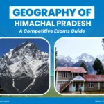
Geographic Location & Map of Himachal Pradesh
Himachal Pradesh may cover only 55,673 km²—less than 2% of India’s land—but it feels truly larger than life. Nestled in the Western Himalayas (30°22′N to 33°12′N latitude and 75°47′E to 79°04′E longitude), the state is a dramatic mix of towering peaks, rolling valleys, and fast-flowing rivers.
The elevation alone tells its story: from the warm low hills of Una at just 350 metres to Reo Purgyil in Kinnaur at 6,816 metres, the highest peak in the state. This variation creates everything from subtropical climates to icy alpine zones, making Himachal a land of incredible diversity.
Geographically, the state rises from west to east and south to north, giving it rugged ranges, deep valleys, and breathtaking landscapes that shape not just its beauty but also its culture and economy. Entire Himachal is mountainous, forming a part of the mighty Western Himalayas, where every valley feels like its own little world.
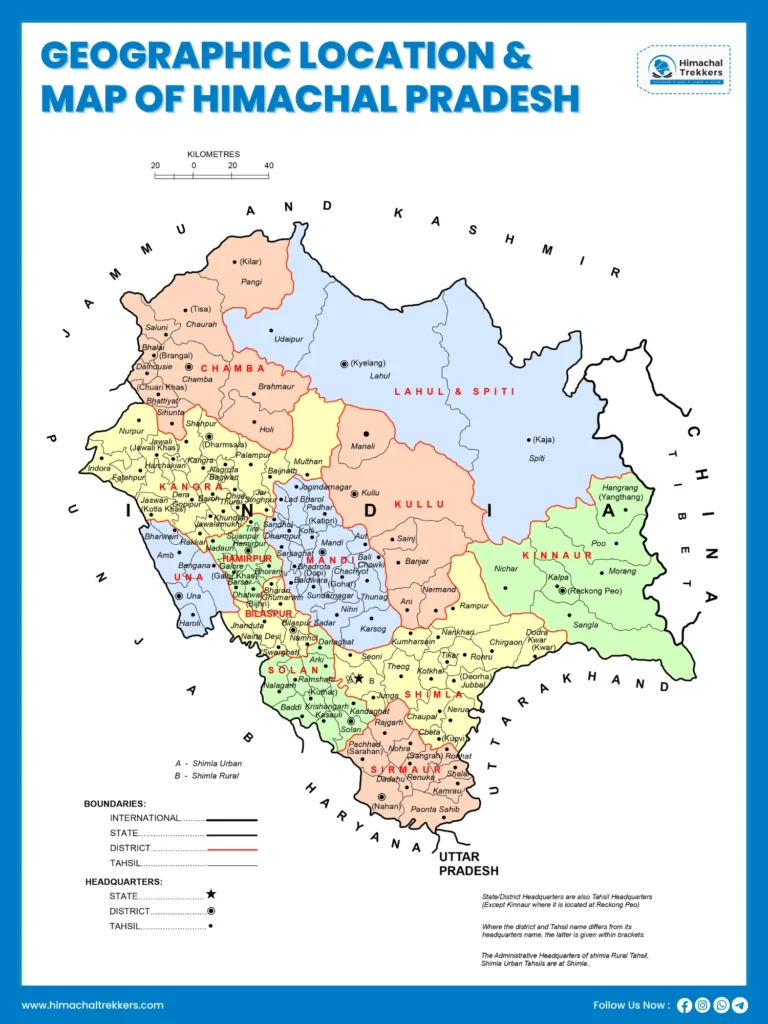
Boundaries of Himachal Pradesh
- North: Union territories of Jammu & Kashmir and Ladakh, with boundaries shaped by the Pir Panjal range and the Spiti Valley.
- West: Punjab, connected through Kangra, Una, Bilaspur, and Solan districts. This border fosters deep cultural and economic ties, from trade to migration.
- South: Haryana, sharing borders with Sirmaur and Solan. This gateway is a lifeline for goods, tourism, and workforce movement.
- Southeast: Uttarakhand, touching Sirmaur, Shimla, and Kinnaur. The Yamuna river forms part of this natural divide.
- Minor Border: In the southern tip near Paonta Sahib, Himachal briefly touches Uttar Pradesh, creating a unique tri-junction.
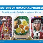
- East (International Border): Himachal shares a boundary with the Tibet Autonomous Region of China via Kinnaur and Lahaul-Spiti districts. This not only makes the state strategically important but also explains the Tibetan cultural influence seen in its monasteries, cuisine, and festivals.
This mix of geography and human connection is why Himachal Pradesh is not just a land of mountains—it’s a land where landscapes and culture grow together.
Physiographic Setting of Himachal Pradesh
When you hear “geography,” the first thing that comes to mind is land and elevation. Himachal Pradesh is almost entirely mountainous, and its altitude ranges dramatically—from just 350 meters near the Punjab border to 6,816 meters at Reo Purgyil in Kinnaur, one of the highest peaks in India. This incredible variation makes Himachal feel like many worlds within a single state.
The state is part of the Himalayan mountain system and can broadly be divided into three main zones:
- The Outer Himalayas (Siwalik Hills) — 350 to 1,500 m
- Altitude: 350–1500 m
- Districts: Kangra, Hamirpur, Una, Bilaspur, and lower parts of Mandi, Solan, Sirmaur
- Rainfall: 1500–1800 mm annually
- Character: Easily eroded soils → high soil erosion, deforestation common. These are the youngest mountain ranges, made of loose sediments. This makes the region prone to erosion and landslides, especially during monsoons.
- The Lesser Himalayas (Inner Himalayas) — 1,500 to 4,500 m
- Altitude: 1500–4500 m
- Districts: Upper parts of Sirmaur, Mandi, Chamba, Shimla
- Ranges: Includes the famous Dhauladhar and Pir Panjal ranges.
- Soils: Silty loam to clay loam, generally fertile.
- Character: Terraced agriculture, pine and oak forests, and especially apple orchards, which Himachal is known for across India.
- The Greater Himalayas (Alpine Zone) — 4,500 to 7,000 m
- Altitude: 4500–7000 m
- Districts: Kinnaur, Lahaul-Spiti, parts of Chamba
- Climate: Harsh, snowbound, sparse population.
- Landscape: Glaciers, high passes, cold deserts, and towering peaks.
- Character: These glaciers are the lifeline of Himachal, feeding rivers like the Sutlej, Beas, Ravi, Chenab, and Yamuna. These rivers support farming, hydropower projects, and daily life downstream.
Himachal Pradesh can also be classified into five eco-climatic zones—Wet Sub-temperate, Humid Sub-temperate, Dry Temperate-Alpine, Humid Sub-tropical, and Sub-humid Sub-tropical. Each of these zones has its own unique climate, vegetation, and farming style.
Landforms Geography of Himachal Pradesh
Himachal’s landforms aren’t just geographical features—they’re the reason for its diverse culture, food habits, festivals, and even architecture. Let’s break them down:
Mountain Ranges in Himachal Pradesh
- Dhauladhar Range – Snowy backdrop for Kangra valley.
- Pir Panjal Range – Separates Kullu from Lahaul-Spiti.
- Zanskar Range – Remote, high-altitude, less explored.
- Great Himalayas – Houses peaks above 6,000 m like Reo Purgyil.
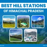
Valleys of Himachal Pradesh
- Kangra Valley – Fertile, scenic, known as Himachal’s “mini Punjab.”
- Kullu Valley – “Valley of Gods,” apple and tourism hub.
- Spiti Valley – Cold desert, Tibetan influence.
- Chamba Valley – Historical temples, ancient routes.
Rivers of Himachal Pradesh Geography
All major rivers of Himachal originate from glaciers.
- Sutlej – Longest, enters from Tibet.
- Beas – Originates at Rohtang, flows through Kullu & Mandi.
- Chenab – From Lahaul, powerful flow.
- Ravi – Short but important, flows through Chamba.
- Yamuna – Forms boundary with Uttarakhand.
Glaciers in Himachal Pradesh
- Bara Shigri (Spiti) – longest glacier (25 km).
- Chhota Shigri (Lahaul).
- Parbati Glacier (Kullu).
Plateaus in Himachal Pradesh
Though rare, Chail Plateau (Shimla) is famous for being home to the world’s highest cricket ground (2,444 m).
Climate Zones & Rainfall In Himachal Pradesh
Himachal Pradesh is more than just cool mountain weather—it’s a state of diverse climates. From warm valleys to snowy highlands and dry cold deserts, each region has its own unique weather patterns. The state offers six unique climate zones, each with its own rhythm of life.
- Sub-humid Sub-tropical (Una, Sirmaur, Kangra valleys): Warm valleys with 24°C average temps and 1,000–1,500 mm rainfall. Nearly 56% of cultivated land lies here.
- Humid Sub-tropical (Hamirpur, Bilaspur, Mandi & Kangra low hills): Moderate 20–24°C climate, 1,200–1,900 mm rain—perfect for farming.
- Wet Temperate (Dharamshala, Palampur, Jogindarnagar): Cool and moist, with lush tea gardens. Dharamshala is the wettest spot with up to 3,400 mm rainfall.
- Humid Temperate (Shimla, Kullu, parts of Solan & Chamba): Mild 13–18°C weather, 1,000–2,500 mm rain—ideal for apple orchards and forests.
- Sub-humid Temperate Alpine (Lahaul-Spiti, Kinnaur highlands): Cool and snowy winters, summers mild, rainfall about 600 mm (mostly snow).
- Frigid Arid (Cold Desert – Spiti & parts of Kinnaur): Dry and harsh, less than 250 mm rain yearly, summers barely reach 13°C.
If we talk about rainfall patterns, most rain falls during the monsoon season (July–September). The west (Kangra, Chamba, Kullu) is lush, while the east (Spiti, Kinnaur) turns into stark cold deserts. Rivers like the Beas, Sutlej, and Ravi depend on this rainfall, powering agriculture and hydropower.
But there’s a flip side—landslides and flash floods during heavy monsoon showers. If traveling in July–August, it’s always wise to check local advisories.
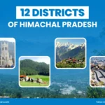
Administrative Divisions In Himachal Pradesh
Himachal Pradesh became a full-fledged state on January 25, 1971, after years of political and regional restructuring. To improve governance, new districts were carved out—Hamirpur and Una separated from Kangra in 1972. Today, the state has 12 districts and these districts are grouped into three main administrative divisions—Kangra, Mandi, and Shimla—for better regional management.
Each district is overseen by a Deputy Commissioner (DC) or District Magistrate (DM), who works with officials handling areas like law enforcement, judiciary, forestry, and development projects. This structure ensures that even remote regions in the mountains get proper governance and resources.
At the local level, the Gram Panchayat forms the backbone of rural administration, with thousands operating across the state. Urban areas, on the other hand, are managed by Municipal Corporations, Councils, and Nagar Panchayats. The administrative setup further extends into sub-divisions, tehsils, and development blocks, making governance more accessible to people in every corner of Himachal.
Supported by a High Court in Shimla and district-level courts, along with police forces led by Superintendents of Police (SPs), these divisions together ensure that law, order, and development reach every valley and village of this Himalayan state.
Education In Himachal Pradesh
The state has achieved an outstanding literacy rate of 99.30%, surpassing the national average of 95%. In fact, in September 2025, Chief Minister Sukhvinder Singh Sukhu proudly declared Himachal Pradesh as the fifth “fully literate” state in India.
The state made primary education compulsory under the Himachal Pradesh Compulsory Primary Education Act, 1997, and has nearly achieved universal school enrolment. Schemes such as the Sarva Shiksha Abhiyan, Rajiv Gandhi Day Boarding Schools, free midday meals, scholarships, and free textbooks and uniforms have ensured access for all sections of society.
Recent reforms have also improved learning outcomes—Himachal Pradesh rose from 21st to 5th place in the 2025 National Achievement Survey for education quality. The state hosts some of India’s premier institutes :
- IIT Mandi, NIT Hamirpur, Himachal Pradesh University, Central University (Dharamshala).
- Agriculture & horticulture universities like CSK Palampur, Dr. YS Parmar Horticulture University.
- Indira Gandhi Medical College (Shimla), Himachal Dental College, art institutes for Kangra miniature painting.
Agriculture & Natural Resources In Himachal Pradesh
Agriculture is the lifeline of Himachal Pradesh, with over 90% of the population depending on farming for their livelihood. It contributes around 9.4% to the state’s economy and employs nearly two-thirds of the workforce. What really makes Himachal stand out is its horticulture.
The state is often called the “Apple State of India”, producing nearly 80% of India’s apples and exporting them nationwide and abroad.
Other fruits like plums, apricots, cherries, mangoes, almonds, and strawberries also flourish, making fruit cultivation a cornerstone of the rural economy. Cereals like wheat, maize, rice, and barley form the staple diet, grown in cropping systems such as maize–wheat, rice–wheat, and maize–potato–wheat. Alongside cereals, farmers cultivate pulses and off-season vegetables like potatoes, ginger, mushrooms, and oilseeds, taking advantage of the state’s varied climate.
Beyond farming, Himachal’s natural wealth is equally vital. Nearly 66% of the state (37,033 km²) is under forest cover, providing biodiversity and supporting sustainable practices like vermicomposting.
The state’s rivers and glacier-fed streams have earned it the name “Powerhouse of India” due to its hydropower potential.
Though only about 10% of the land is cultivable—with acidic, low-fertility soils—initiatives like Prakritik Kheti Khushhal Kisan Yojna are promoting natural farming. Himachal is also rich in minerals such as limestone, gypsum, and mica, balancing agriculture with natural resource use.
Together, farming and natural resources form not just the backbone of the economy but also a way of life, closely tied to Himachal’s culture and traditions.
Environmental Initiatives In Himachal Pradesh
Himachal was declared India’s first smoke-free state and is known for state-wide bans on polythene and robust afforestation.
Environmental Challenges:
- Frequent landslides (especially in monsoon)
- Flash floods in rivers/valleys
- Glacial retreat in Spiti and Kinnaur
- Earthquake-prone zones, especially Kangra, Chamba
The state actively promotes clean energy, eco-tourism, and reforestation.
Himachal was declared India’s first smoke-free state and is known for state-wide bans on polythene and robust afforestation. Himachal Govt has implemented major environmental initiatives focused on green energy, waste management, forest conservation, and clean mobility, while being vulnerable to a range of geohazards including earthquakes, landslides, floods, and forest fires.
Key Environmental Initiatives
- Plastic Ban: 500 ml plastic water bottles banned; strict rules for plastic use in hotels, government programs, and events.
- Clean City Campaign: Launched February 2025; focuses on urban waste management, sanitation drives, and community awareness with NGOs and self-help groups.
- Green Energy Vision: Aims to be a Green Energy State by 2026; promotes solar power, electric vehicles with subsidies and infrastructure, and afforestation.
- Sustainable Agriculture & Biodiversity: Programs encourage natural farming, agroforestry, and sustainable water and hydropower management to reduce pollution.
- Green Panchayat Scheme: Enables village councils to set up grid-connected solar facilities; a green hydrogen production facility is under development.
- Tree Plantation Drive: Pollution Control Board’s Pollution Abating Plant Abhiyan targets planting 400,000 trees at eight locations to improve air quality.
Conclusion
Himachal’s geography isn’t just about learning ranges and rivers—it’s about understanding how people and land coexist, and how natural beauty comes hand in hand with challenges like landslides, floods, and earthquakes. It directly influences agriculture, hydropower, settlement patterns, and cultural diversity. From the Siwalik foothills to the Greater Himalayas, the state’s physiography explains its economy, lifestyle, and environmental challenges.
Understanding Himachal’s geography, therefore, means understanding its people, resources, and development challenges, while also appreciating why this small Himalayan state holds such immense strategic, cultural, and ecological importance for India.